Second Edition, 2025!
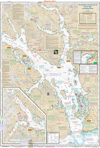
The Kayaker’s Companion to
Glacier Bay: Annotated Chart
by David Bahr
A kayaker's best friend for Glacier Bay, AK
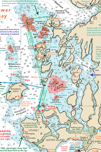
This incredibly detailed, waterproof, and tear-resistant nautical chart covers all of Glacier Bay, showing over 291 campsites, reliable water sources, Park Service pickup and drop-off locations, notable hazards, tidal cut depths, non-motorized wilderness waters, and more.
The map includes new shorelines created by receding glaciers, new tidal flats, updated glacier positions, recent wildlife closures, and important corrections to errors on other maps and charts.
For ease of use, each campsite is keyed to the corresponding chapter and campsite number in The Kayaker's Companion to Glacier Bay, Volumes 1, 2, and 3, Second Edition.
This map is ideal for sea kayakers. It includes the best data from NOAA's nautical chart, to which I've added over 2,000 new features, corrections, updates, rip tide locations, fun science and history notes, and other key info for paddlers.
The standard map is pleasingly large. A huge version with twice the square footage is also available for wall displays, for seeing details while paddling without glasses, and for those who love the fine details. The huge chart can be cut in half, if desired, and will still be waterproof.
Details:
- Waterproof
- Tear resistant
- Copyright: 2025
- Large size: 24.4 by 36 inches (scale: 1:100,000)
- Huge size: 36 by 53.25 inches (scale: 1:68,000)
Shipping Destination:
Shipping:
- Large: $14.75 UPS/USPS 2/3-day (up to 3 maps)
- Huge: $29.75 UPS/USPS 2/3-day (domestic US)

